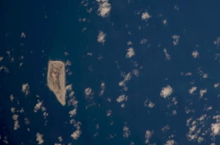
Jarvis Island, July 2008On 8 July 2008, Spaceref.com wrote that the International Space Station would was due to orbit over Jarvis Island.
As ISS approached this area from the NW near mid-morning, Greg was to look for the W-to-E meandering flow of the river and map the area west of the man-made Lake Texoma), and Jarvis Island, Equatorial Pacific (this unusual, trapezoid-shaped island is located just south of the equator about halfway between Hawaii and the Cook Islands. It is low-lying, uninhabited, has very little vegetation and is just about 2 miles long and 1 mile wide. CEO is assisting international efforts to document and monitor the Earth's coral reef systems. On this late morning pass, looking just left of track for this target, then using the long lens settings for detailed views of the fringing coral reefs, especially those on the eastern side).
A few weeks later, a single photograph was uploaded to the Gateway to Astronaut Photography of Earth, which does not meet the above description at all.  Photo by NASA. |