
Bathymetry of Jarvis Island
A Bathymetric grid of Jarvis Island at 20 meters. Source: Pacific Islands Benthic Habitat Mapping Center
A Bathymetric grid of Jarvis Island at 5 meters. Notice the large shoal on the east coast, which can easily be seen in aerial photography. This shoal is another reason why landing is more easily accomplished on the west coast as opposed to the east coast. Source: Pacific Islands Benthic Habitat Mapping Center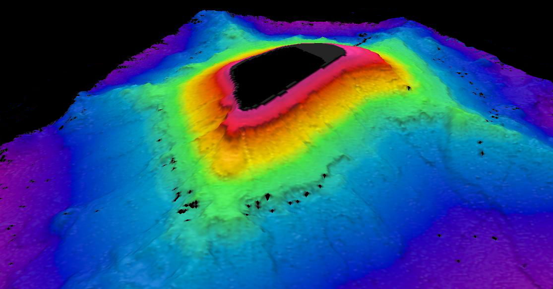
3D view of a Bathymetric grid of Jarvis Island at 5 meters. Source: Pacific Islands Benthic Habitat Mapping Center |